Navigation

Underwater Positioning

Underwater positioning technologies allow precise navigation and tracking in the water column.

Our solutions include:
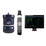
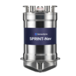
  • Inertial navigation systems (INS) & DVL (Doppler Velocity Log)
  • Surface positioning beacons (Radio/Satellite)
  • Acoustic pingers and receivers
  • USBL (Ultra Short BaseLine) & LBL (Long BaseLine) systems

Underwater positioning equipment

USBL RANGER 2

USBL & LBL

Used to transmit and receive acoustic signals underwater for precise localization.

How it works :

  • A transducer sends acoustic signals to submerged transponders.
  • The response signal is analyzed to calculate distances and triangulate positions.

Applications :

  • Accurate subsea equipment tracking
  • Dynamic positioning of AUVs/ROVs
  • Acoustic data transmission
  • Triggering release mechanisms on seafloor stations 
DVL BD

DVL

Measures the velocity and altitude of a vehicle -drone or vessel- relative to the seabed.

How it works :

  • Acoustic pulses are emitted and reflected off the seabed.
  • The Doppler Shift is used to calculate motion and height above the bottom.

Applications :

  • Staying on course and/or maintaining altitude and direction following the underwater relief
  • Station-keeping in strong currents
  • Enhanced stability during ROV operations
Pinger receiver

Pingers & receivers

Acoustic transponders that emit and detect signals for localization.

How it works :

  • Emits coded acoustic pulses
  • Measures echo return to assess distance and location

Applications :

  • Emergency recovery of drones or subsea vehicles
  • Black box location
  • Underwater object tracking

Surface Positioning

Nearshore and offshore operations require accurate surface positioning, which is vital for safety and operational efficiency. Neotek provides reliable GNSS, RF, and satellite communication systems for SAR (Search and Rescue), navigation, and monitoring.


Our systems include:
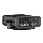
  • AIS receivers and transponders
  • High-precision direction finders (goniometers)
  • VHF/UHF modems
  • Satellite communication modules (Iridium, ARGOS, Starlink)
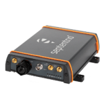
  • GNSS receivers (GPS, Galileo, Beidou, Glonass)

Surface Positioning

COMAR RECEPTEUR AIS V2

AIS Receivers & Transponders

Track vessel identity, location, and movement in real time.

How it works :

  • Captures VHF signals from nearby AIS-equipped vessels
  • Decodes vessel data: ID, GPS position, speed, course
  • Displays or integrates data into navigation software

Applications :

  • Collision risk mitigation
  • Maritime traffic monitoring
Goniometre Rhotheta

Goniometers

Determine the direction of RF signals for navigation and rescue.

How it works:

  • Captures radio waves from beacons or transmitters
  • Calculates the angle-of-arrival (AoA) of the radio-frequency waves to locate the signal source
  • Triangulates emitter position

Applications :

  • Locating radio beacons in distress
  • Coastal or offshore navigation
  • Assisting Search and Rescue teams in locating small craft
GNSS BD

GNSS (Global Navigation Satellite Systems)

Global satellite-based positioning for real-time marine navigation.

Main satellite constellations:

  • GPS (USA)
  • Galileo (EU)
  • Glonass (Russia)
  • Beidou (China)

Capabilities:

  • 3D positioning (longitude, latitude, altitude)
  • Speed and time synchronization
  • High accuracy for surface and airborne platforms
balise radio 2

Radio / Satellite Beacons & Light Markers

Rugged and autonomous beacons to secure subsea assets.

Features :

  • Long-endurance passive or programmable systems
  • Depth-rated up to 12,000 meters
  • Remote activation and recovery support

Users :

  • Marine research organizations
  • Oceanographic institutes
  • Operational oceanography programs